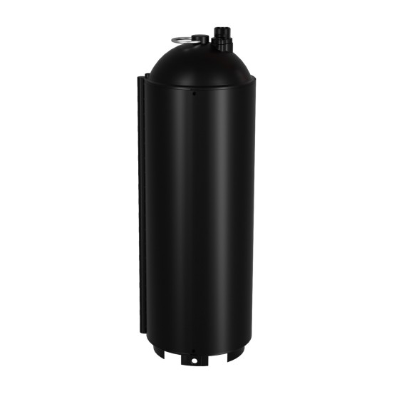
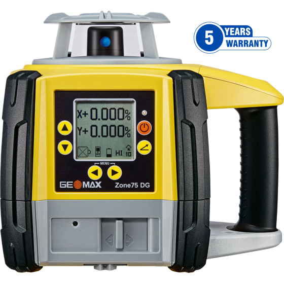
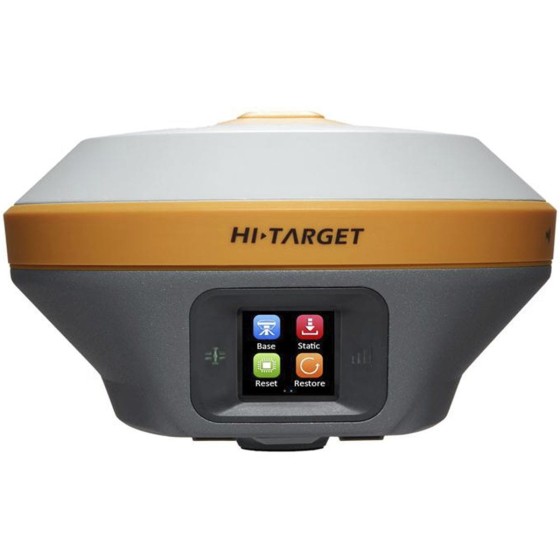
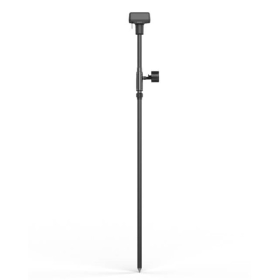
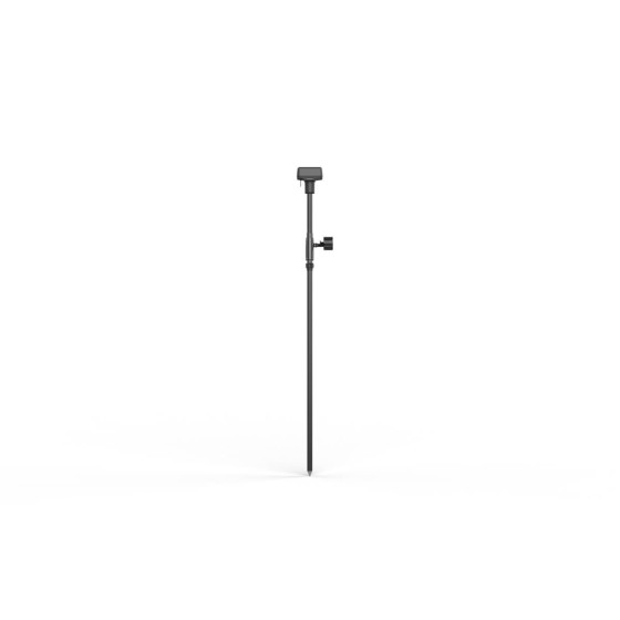
DJI D-RTK 2 High-Precision GNSS Mobile...
DJI D-RTK 2 High-Precision GNSS Mobile Station
Supports mainstream global satellite navigation systems and provides real-time differential corrections for centimeter-level precision.
Filter By
Brand
Brand
Price
Price
Use
Use
Horizontal circle
Horizontal circle
Magnification
Magnification
Single Prism Range
Single Prism Range
Reflectorless Range
Reflectorless Range
Accuracy at 1 km double leveling
Scope Magnification
Scope Magnification
Tripod Material
Tripod Material
Detectes
Detectes
Laser Beam
Laser Beam
Tilt Sensor
Tilt Sensor
Compatible with
Compatible with
Model
Model
Included Sensor
Included Sensor
Channels
Channels
UHF Radio modem
UHF Radio modem
Screen
Screen
Photo Resolution
Photo Resolution
Receiver for use with
Maximum Depth
Maximum Depth
Pole for use with
Pole for use with
Level Type
Level Type
Range
Range
Accuracy (mm to 10 meters)
Digital Pointfinder
Digital Pointfinder
Tripod Type
Tripod Type
Automatic Level Set
Automatic Level Set
Laser Type
Laser Type
P2P Package
P2P Package
Touchscreen
Touchscreen
Tripod connection 1/4"
Tether Length
Tether Length
IMU
IMU
Slope Setting
Slope Setting
Type
Type
Lock System
Lock System
Total Station Type
Total Station Type
Angle measurement accuracy
Meter
Meter
Working Range with Receiver Ø
Automatic End-Piece
Automatic End-Piece
Duty Type
Duty Type
Measurement Type
Measurement Type
Incorporated Laser Beam
Staff for use with
Staff for use with
Horizontal Levelling
Vertical Levelling
Vertical Levelling
Tripod Thread
Tripod Thread
Optical Plummet
Optical Plummet
Features
Features
DJI D-RTK 2 High-Precision GNSS Mobile Station
Supports mainstream global satellite navigation systems and provides real-time differential corrections for centimeter-level precision.
Based on a fully digital platform, the Tx family of signal transmitters has been designed to complement Radiodetection’s advanced high-precision cable and pipe locators including the RD8200 and Marker Locator ranges.
The Tx range is designed to meet the demands of tracing utilities through today’s complex underground infrastructure. The Tx-5 has a medium power and induction capability as well as Fault-Find. The Tx-10 has the highest power capability with both Fault-Find and CD modes as standard.
HTS-521L10 adopts a high-definition color screen to provide better human-computer interaction. The new optical design and absolute coding technology improve the measurement performance. High-precision compact bead shafting and sealed encoder disk enhance accuracy and stability. Built-in abundant measurement programs and comprehensive maintenance procedures will provide a new measurement experience.
Qmini A10 GIS Handheld provides a combination of Beidou high-precision positioning, dual-mode intercom, 4G smartphone, with background multi-network interconnection and other functions. It is small with complete functions and a high level of protection. Besides, it is a new type of rugged centimeter-level precision intelligent terminal product.
Flexible|Stable|Endless exploration
CHASING M2 S is an industrial-grade revolutionary underwater robot, which adopts an open-body design, intelligent flight control system and image algorithm, bringing unprecedented underwater perception and freedom of movement. 8 vectored-thrusters are symmetric and anti-stuck C-Motor 3.0 provide stable power, while the flagship sealed structure guarantees underwater operation performance. The ROV is compact and lightweight, easy to operate, and efficiently completes inspection tasks in various underwater operating scenarios in different industries.
-Locating and marking buried utilities quickly, accurately and safely-
The new RD7200 is a no compromise all-industry locator, designed for accurate and effective every day use.
Intended Use:
It is an exclusive battery customized for CHASING M2 PRO MAX, supporting various devices. It performs excellently in extending the battery life for CHASING M2 PRO MAX and solving battery life problems of ROV in industry application.
The GeoMax Zoom10 Manual Total Station is what you get when you put affordability and efficiency into one manual total station. It is a high-performing entry-level survey instrument available at an excellent price point.
Highlights
Note: X-PAD field software is sold separately.
Easily perform leveling tasks over great distances with the Geomax Zone75 DG Fully-Automatic Dual Grade Laser. This rotary laser provides the same high-level performance as Zone80 (phased out in 2021) but with a reduced rotation speed of 900rpm, enabling it to produce a more stable beam at distances of up to 550 meters away from the laser. This makes it a great choice for land leveling and agriculture applications.
Highlights
FIFISH V6 EXPERT is a professional-class underwater robot and multi-capable tool for enhancing your underwater missions and operations. The V6 EXPERT can be equipped with an onshore power supply system that delivers optimal diving performance and operating time.
CHASING Control Console is a professional underwater drone control platform designed for high-end professional users. It is used to control the ROV, USV, AC Power, USBL, Grabber Claw, Multibeam Sonar, External Light and other professional accessories, and its ergonomic design makes underwater work more professional and convenient.
Schneider Digital’s 3D PluraView is the enhanced successor of PLANAR’s discontinued Beamsplitter series, as well as the NVIDIA 3D Vision Pro. Innovative, reliable technology is the basis for precise, pixel-accurate, stereoscopic image evaluation in the highest quality, even in daylight. For this, 3D PluraView Beamsplitter technology delivers full monitor resolution up to 4K/UHD @ 10-bit in brilliant brightness thanks to one display per eye. This allows the user to work comfortably and without fatigue in all 3D stereo applications.
Flexible|Stable|Endless exploration
CHASING M2 S is an industrial-grade revolutionary underwater robot, which adopts an open-body design, intelligent flight control system and image algorithm, bringing unprecedented underwater perception and freedom of movement. 8 vectored-thrusters are symmetric and anti-stuck C-Motor 3.0 provide stable power, while the flagship sealed structure guarantees underwater operation performance. The ROV is compact and lightweight, easy to operate, and efficiently completes inspection tasks in various underwater operating scenarios in different industries.
Capture More, Worry Less
Special Promotion Price
Grab the V10i and get measuring. Integrating an OLED screen, IMU, and two cameras, the V10i gives us a next-level productivity boost. The AR Stakeout gives you real-time visual guidance on stakeouts. The Visual Measure achieves the measurement of hard-to-access locations. An OLED screen will bring a new interactive experience for Surveyors.
iRTK5 is the new high quality GNSS receiver of Hi-Target, benefiting from the next-generation GNSS engine. It has full band support for cellular mobile networks (LTE, WCDMA, EDGE,GPRS,GSM), and supports most of the radio protocols on an internal UHF transceiver radio.
The Qpad X8 Rugged Tablet integrates the high-precision GNSS algorithm to provide users with a consumer-grade smart tablet experience for GIS data collection in various industries.
HTS-720 features a 5.5-inch touch high-definition large screen, powered by the Android operating system and our brand-new Android measurement software. With the addition of a built-in camera, measuring and stakeout tasks have never been easier. Plus, the HTS-720 boasts a high-performance processor, enabling users to select stakeout points and lines with just one click in CAD stakeout interface, making the entire stakeout process more intuitive and efficient.
CHASING M2 Pro is a professional underwater ROV designed for professional users and industrial applications. M2 Pro has 8 Vectored Thrusters layout allows OMNI movement in all directions. Compared to the CHASING M2, the M2 Pro has been upgraded by 50%. The Maximum speed is 4 knots, depth is 150 meters and the maximum horizontal radius is 400 meters.
Damage prevention and operational efficiency are the biggest challenges facing our customers
Solve these problems with the new RD8200®. Designed with the operator in mind, it is our most advanced and capable range of precision locators.
Intended Use:
The Zenmuse P1 integrates a full-frame sensor with interchangeable fixed-focus lenses on a 3-axis stabilized gimbal. Designed for photogrammetry flight missions, it takes efficiency and accuracy to a whole new level.